Purpose
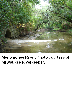
Watershed plan update 2010. The Menomonee River Watershed covers 136 square miles in portions of Washington, Waukesha and Milwaukee counties. The Menomonee River originates in wetlands near the Village of Germantown and the City of Mequon and runs south, southeast for about 32 miles where it meets the Milwaukee and Kinnickinnic Rivers in the Milwaukee Harbor.
Nearly all of the land area in this watershed is within incorporated municipalities. Forty-two percent of the land is covered by urban uses. Grasslands (22%), agriculture (17%) forests (8%) and wetlands (7%) make up most of the remaining land uses.
There are no named lakes within this watershed. Some park ponds provide for some recreational opportunities for urban fishing.Study Design
Watershed specified for planning and assessment purposes. Assessment of water quality condition in this respective county will use protocols described in WisCALM of the year of assessment. Minimum assessment work includes biological data (macroinvertebrates, fish indices), chemistry and habitat data. Additional work includes identification of priorities and goals, creating recommendations for actions, and updating narratives for watersheds and waterbodies. Assessments are to be double checked by at least one additional biologist.Related Reports
Run Project Summary ReportView Umbrella-ProjectsView Related-ProjectsWater Quality Planning
Targeted Watershed Plans
MI03_WTPLAN
2009
Complete
EPA-approved QAPP for fish monitoring
Watershed at a Glance
Assessments and recommendations for the Watershed.
Water Quality Planning
Project: Menomonee River (MI03) Watershed Planning
Best Management Practices, Implement
Design & construct wet detention basin at 91st & Dean.