Project Title
Douglas and Rathbone - Soper Creeks TWA WQM PLAN 2017 (BR03)
Camille Bruhn, Primary Author and Investigator, West District, Wisconsin DNR,
Big-Douglas Rathbone-Soper Cr TWA WQM Plan (BR03 [PDF]
Study Purpose & Setting
The overall goal of this plan is to improve and protect water quality in the basin. This Targeted Watershed Assessment monitoring project provided substantial data to analyze current conditions and to make recommendations for future management actions in the area. This plan is designed to present monitoring study results, identify issues or concerns in the area found during the project and to make recommendations to improve or protect water quality consistent with Clean Water Act guidelines and state water quality standards.
Study Summary
Targeted Watershed Assessment (TWA) was conducted in the Big-Douglas HUC 10 and Rathbone-Soper HUC 12 watersheds. The Rathbone and Soper Creeks HUC 12 subwatershed lies at the eastern end within the Big and Douglas Creeks watershed and was identified for evaluation due to stressed biological surveys. The Rathbone-Soper HUC 12 watershed was selected as one of the TWAs for the Western District to monitor in the 2014 field season. Nineteen sites throughout the watershed were selected for fish, habitat, macroinvertebrate, and water chemistry sampling. The sites were monitored in 2014 to evaluate and document current stream conditions and potential impairments (Figure 4). An additional eight sites in the adjacent Rathbone-Soper HUC 12 subwatershed were surveyed for a more targeted assessment of this smaller area, including the pour point of the watershed which included growing season total phosphorus sampling. A total of twenty-seven sites were surveyed in the HUC10 watershed and HUC12 subwatershed.
Management Priorities
It is a priority to work with the landowners and Jackson, Monroe, and La Crosse County staff to educate landowners and install BMPs in any agricultural areas that will help protect the water quality and maintain good stream health in the watersheds. It is important to continue work with landowners to prevent erosion of banks and deter fine sediments from entering streams by increasing and improving riparian areas. Encouraging stabilization of banks with vegetated buffers planted in grasses and forbs will help prevent erosion, act as natural cover for fish, and reduce sediment and nutrients flowing to the streams. Managed grazing, rotational grazing, and stream crossings should be considered in the riparian corridors to help mitigate bank erosion and trampling and protect riparian areas. In row cropped areas, buffers, cover crops, no-till farming and implementation of nutrient management plans would help reduce bank erosion and runoff of sediment and nutrients to the streams. View Map of Local Area by Clicking Here
Recommendations
 * The department should work with watershed organizations and county land and water conservation departments on outreach efforts with landowners in the watershed to educate citizens on the importance of streams and techniques for preserving and improving stream corridors and reducing fine sediment delivery to streams.
* The department should review land use and nutrient management efforts in the Big-Douglas watershed and Rathbone-Soper subwatershed to determine if any improvements can be made to reduce phosphorus delivery to the streams.
* Dustin Creek should be considered for listing in the 2018 or later impaired waters list due to exceedances of the total phosphorus criteria.
* Rathbone and Jenkins Valley Creeks should have additional phosphorus monitoring to determine if the phosphorus criteria is exceeded; the samples collected should fill known gaps in monthly data for the statistical approach used for assessments.
* Monitoring of phosphorus concentrations in the streams of the Big-Douglas and Rathbone-Soper Creeks areas should continue as funding and volunteer efforts allow.
* In areas with heavy grazing, managed grazing and rotational grazing could be implemented to protect riparian corridors. Other agricultural practices and nutrient management plans could help reduce erosion and runoff to streams.
* Follow up monitoring should be completed on streams with poor IBI scores or lack of fish to further evaluate conditions.
* Habitat improvements could be implemented on streams that have documented steep eroding banks if funding becomes available.
Resources
Rathbone and Soper Creeks originate on the east side of the watershed and flow west before joining Big Creek, which flows into the Black River. There are 375 miles of streams in the Big-Douglas Creeks watershed, of which 43.3 miles are outstanding or exceptional resource waters, 74.9 miles are trout waters, and 80.8 miles are impaired. Rathbone and Soper Creeks are part of the Big and Douglas Creeks watershed (BR03).
The Big and Douglas Creeks watershed encompasses approximately 210 square miles in Jackson, Monroe and La Crosse counties. A small portion also lies in Trempealeau County. The conversion of land to agricultural uses is not extreme. However, the sandy soils, which characterize this watershed, are prone to erosion with little disturbance. Many streams within the watershed naturally contain shifting sand bottoms. Some streams have exposed banks that contribute sand and sediment during high flow events.
Land Use
The Big and Douglas Creeks watershed is 210.33 mi?. Land use in the watershed is primarily forest (53%), agricultural (33%) and a mix of grassland (7%) and other uses (7%) open land and water, wetlands, and suburban (Figure 2). This watershed has 375.17 stream miles, 473.57 lake acres and 7,564.97 wetland acres.
Ecological Landcapes
This watershed is located in the Western Coulee and Ridges Ecological Landscape in southwestern and west central Wisconsin and is characterized by its highly eroded, driftless topography and relatively extensive forested landscape. Several large rivers including the Wisconsin, Mississippi, Chippewa, Kickapoo and Black flow through or border the Ecological Landscape. Historical vegetation consisted of southern hardwood forests, oak savanna, scattered prairies, and floodplain forests and marshes along the major rivers. With Euro-American settlement, most of the land on ridgetops and valley bottoms was cleared of oak savanna, prairie, and level forest for agriculture
The steep slopes between valley bottom and ridgetop, unsuitable for raising crops, grew into oak-dominated forests after the ubiquitous presettlement wildfires were suppressed. Current vegetation is a mix of forest (40%), agriculture, and grassland with some wetlands in the river valleys. The primary forest cover is oak-hickory (51%) dominated by oak species and shagbark hickory. Maple-basswood forests (28%), dominated by sugar maple, basswood and red maple, are common in areas that were not subjected to repeated presettlement wildfires. Bottomland hardwoods (10%) are common in the valley bottoms of major rivers and are dominated by silver maple, ashes, elms, cottonwood, and red maple. Relict conifer forests including white pine, hemlock and yellow birch are a rarer natural community in the cooler, steep, North Slope microclimates.
Hydrology
The Big and Douglas Creeks HUC 10 watershed covers roughly 210 square miles in Jackson, La Crosse, and Monroe counties. Sandy soils dominate throughout the watershed and are easily susceptible to erosion. The streams throughout the watershed are comprised mostly of shifting sand bottoms and some streams have unprotected banks that contribute sand and sediment during high flow events, such as major storms. Sand and sediment deposits reduce the depth of streams and when combined with high flows, can widen the streams. As streams become wider and shallower, temperatures can rise and exceed the range conducive to the survival of trout.
Natural Communities
Most of the streams in the Big-Douglas Creeks HUC 10 are modelled to be coldwater or cool-cold headwaters or mainstems (Lyons, 2008). The department has recently developed a draft method to determine whether or not the modeled natural community is accurate based on the fishery assemblage and climate conditions (Lyons, 2013). In most cases, the thermal composition of species (cold, warm, or transitional) indicated these streams were generally modeled correctly. The streams in the Rathbone-Soper Creeks HUC 12 were also modelled to be coldwater or cool-cold headwaters or mainstems (Lyons, 2008). All stream sites surveyed for fish were verified to agree with the model in this subwatershed.
Site Selection & Study Design
The Rathbone and Soper HUC 12 subwatershed lies at the eastern end within the Big and Douglas Creeks watershed. This subwatershed was selected for evaluation due to stressed biological surveys. Nineteen sites were sampled throughout the Big-Douglas Creeks watershed, and an additional eight sites were selected in the Rathbone-Soper subwatershed specifically to get a more targeted assessment of this smaller area
The Rathbone-Soper TWA consisted of Fish Index of Biological Integrity (FIBI), Macroinvertebrate Index of Biological Integrity (MIBI) surveys, Hilsenhoff Biotic Index (HBI), total phosphorus (TP) samples, and qualitative habitat surveys conducted at 8 sites as well as at 19 sites within the Big-Douglas Creeks HUC 10. Five of the HUC 10 and 2 of the HUC 12 sites had growing season phosphorus collected. There were six additional one-time grab phosphorus samples collected throughout the Rathbone-Soper Creeks HUC 12 watershed. One of the growing season phosphorus sites, the pour point of the HUC 12, also received six growing season TP samples, along with one time nitrogen series, total suspended solids and chloride samples.
Methods & Procedures
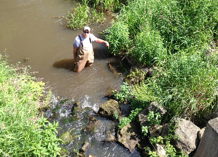
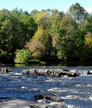 Fish surveys were completedat twenty-seven sites throughout the Big and Douglas Creeks HUC 10 watershed (eight sites were specific to the Rathbone and Soper Creeks HUC12). Backpack and stream shocking equipment were used following the current protocol for assessing fish communities (WDNR, 2001). Fish species were identified and counted at each site and the data was used to calculate an FIBI score for each site. The IBI is a multimetric index that rates the existing structure, composition, and functional organization of the fish assemblage with regional and habitat-specific expectations derived from comparable high-quality ecosystems? (Lyons et al., 1996).
Qualitative habitat surveys were completed at each site on the same day that the fish surveys were conducted according to the current protocol (WDNR, 2007). The habitat survey station length is based on the mean stream width (MSW) multiplied by 35, with a minimum station length of 100 meters and a maximum of 400 meters. There are seven different visually estimated habitat parameters that are recorded for streams less than 10 meters wide. Visual estimations were made while performing fish survey collections and other stream assessments and recorded on the qualitative habitat form after observing the entire station length. Each habitat parameter was given a numeric score and a rating of excellent, good, fair, or poor. The numeric value for all seven parameters was then summed to provide an overall rating of stream habitat quality (excellent 75, good 50-74, fair 25-49, and poor <25).
Aquatic invertebrates were also sampled at each site using a D-framed kicknet and collecting macroinvertebrates according to the protocol for wadeable streams (WDNR, 2000). Kicknet samples were collected from riffle areas and preserved with denatured alcohol. The samples were then sent to the University of Wisconsin - Stevens Point for sorting and identification. The macroinvertebrate results were evaluated using the Hilsenhoff Biotic Index (HBI) which provides a relative measure of organic loading to a stream based on the invertebrates that are present (Hilsenhoff, 1987). The HBI ranges on a scale from 0 to 10, where water quality improves as the index score decreases.
The MIBI was also used to evaluate the quality of each stream site. The MIBI was developed for streams within specific ecoregions of Wisconsin. The IBI includes metrics related to assemblage composition, structure, and function and it assesses a wide range of environmental conditions including land use, habitat, and water quality (Weigel, 2003). The MIBI also uses a scale ranging from 0 to 10, where overall stream quality and biotic integrity improves as the score increases.
Water quality measurements were also collected. Grab total phosphorus samples were collected monthly from May through October at seven locations- five at the pour points in each HUC12 subwatershed within the Big and Douglas Creeks HUC10 and two within the Rathbone and Soper-Creeks HUC12 subwatershed. Samples were collected and analyzed following criteria outlined in the Wisconsin 2014 Consolidated Assessment and Listing Methodology Document (WisCALM) (WDNR, 2013). The total phosphorus water quality criterion for wadeable streams is 75 ug/L and can be found in NR 102.06 of Wisconsin Administrative Code. WisCALM describes the procedure to evaluate total phosphorus data by calculating a 90% upper and lower confidence limit. If the lower confidence limit (LCL) exceeds the criteria by two fold (150 ug/L for wadeable streams) an overwhelming exceedance of the criterion is found and the stream is placed on the impaired water list.
Study Results
The survey site results for both the Big and Douglas Creeks HUC10 watershed and the Rathbone and Soper Creeks HUC12 subwatershed organized by waterbody. Click on the link below to see a list of waters and their condition updates. Big Soper Creeks Water Condition
River/Stream Health
A watershed fishery is a long-term gauge of conditions in the stream and is therefore most important for bioassessment. That is not to say measured water temperatures are not useful, but for natural community determination and IBI purposes, and in the absence of moderate to severe environmental perturbation, the fishery assemblage trumps water temperature data (Lyons, personal communication).
Fish Species Found
There were fifteen species found within the Big-Douglas Creeks watershed. The two fish species most commonly found were brook trout and burbot. Brook trout prefer cool, clear, headwater streams (Becker, 1983). Burbot are accustomed to spending time in cool waters of large rivers, or their tributaries (Becker, 1983). Of the fifteen species present, three were intolerant, four were tolerant, and eight were intermediate species. In the Rathbone-Soper Creeks HUC 12 subwatershed, nine species of fish were found in the eight sites surveyed. The two fish species most commonly found were brook trout and central mudminnows. The central mudminnow prefers pools or areas with no or slow flowing waters and areas that are moderately to densely vegetated (Becker, 1983). Of the nine species found, two were intolerant, four were tolerant, and three were intermediate.
Index of Biological Integrity Findings
The fishery is only one environmental indicator and for this reason, the quality of the resources should be looked at in the context of overall conditions including habitat and macroinvertebrates. The cool water IBIs (Lyons, 2012), when applied to the natural community indicated by the fishery assemblage, rates the fishery of these systems to be poor to excellent. Ten of the twenty-seven total sites did not have an FIBI rating due to too few fish collected. Twelve of the twenty-seven sites were good to excellent, which indicates that there is suitable habitat and adequate water quality conditions in about half of the stream sites.
Macroinvertebrate Data
Macroinvertebrate data is also useful in characterizing stream conditions. The sites in the Big-Douglas and Rathbone-Soper Creeks watersheds had macroinvertebrate IBI values ranging from fair to excellent. The macroinvertebrate IBI scores did not always correlate with the habitat scores and at some sites the macroinvertebrate IBI was good or excellent and the associated habitat was poor or fair. Local stressors may be influencing the macroinvertebrate communities in these areas.
Habitat Scores
Habitat scores throughout all sites surveyed generally ranged from poor to good, with only one site in the Rathbone-Soper subwatershed having a rating of excellent, which could be due to the habitat restoration work that was performed at this site in the past. The main limitations to habitat were fine sediment deposition, bank erosion, and lack of fish cover and complex stream characteristics, such as riffles and deeper pools.
Phosphorus Concentrations
Growing season phosphorus concentrations varied among streams and sites. The listing methodology for impaired waters (WDNR, 2013) recommends listing sites where the median phosphorus concentration exceeds 0.075 mg/l on wadeable streams and 0.1 mg/l on rivers. The impairment listing protocol uses a 90% confidence interval about the median for listing streams and rivers. All five sites in the Big-Douglas Creeks watershed that had growing season phosphorus concentrations collected that were higher than the wadeable statewide standard. This is consistent with the existing 303(d) impaired waters listing for each of the following streams: Big Creek, Davis Creek, Douglas Creek, Roaring Creek, and Sand Creek. Eight sites were sampled for phosphorus in the Rathbone-Soper Creeks subwatershed.
Growing season phosphorus sampling on Soper Creek confirms the existing 303 (d) impaired waters listing. Dustin Creek had a median growing season phosphorus concentration of 0.22 mg/L, which is higher than the 0.075 mg/L standard and this stream may be proposed for impairment listing in the next cycle due to levels higher than the nutrient criteria. Of the three grab phosphorus samples collected on Rathbone Creek, two were below the standard and one exceeded the standard. Additional growing season phosphorus sampling should be conducted on Rathbone Creek to get a more complete representation of phosphorus concentrations. A single grab total phosphorus sample on Jenkins Valley Creek was also higher than the statewide phosphorus standard and additional growing season sampling will be needed to assess for phosphorus exceedance.
Management Recommendations
DNR should work on outreach efforts with landowners and County conservation staff to increase the size and condition of riparian areas in order to buffer stream systems, create fish habitat, and decrease the amount of fine sediments entering the streams.
Habitat improvements could also be implemented on streams that have documented steep eroding banks if funding becomes available.
Continue monitoring water quality parameters or coordinate for volunteers to monitor streams that may have high phosphorus levels that exceed statewide criteria.
Monitoring Recommendations
1. Phosphorus monitoring is important to determine stream health and condition and should be conducted as funding and volunteer efforts allow.
2. Dustin Creek should be considered for listing in the next 303(d) cycle due to exceedances of the total phosphorus criteria.
3. Rathbone and Jenkins Valley Creeks should have more phosphorus monitoring completed in order to determine if the phosphorus criteria is exceeded within those streams.
4. Follow up monitoring should be completed on streams with poor IBI scores or lack of fish to further evaluate conditions.
Partner Recommendations
1. Several stream sites throughout the Big-Douglas watershed and Rathbone-Soper subwatershed have banks that are highly eroded. Grant programs and funding opportunities to seek BMP support should be pursued as relevant in the future.
2. Educating landowners on stream bank protection is a crucial factor in protecting stream resources and funds may be available for agricultural landowners to implement BMPs to help protect stream banks and reduce upland soil erosion.
3. In areas with heavy grazing, managed grazing and rotational grazing could be implemented to protect riparian corridors. Other agricultural practices such as buffers, cover crops, no-till farming, and nutrient management plans could help reduce erosion and runoff to streams.
4. Citizen volunteers can also help by monitoring streams for phosphorus concentrations to identify areas that may need more nutrient reduction practices.
Monitoring and Planning
 Watershed OverviewThis Water Quality Management Plan was created under the state?s Water Quality Management Planning and Water Resources Monitoring Programs. The plan reflects Water Quality Bureau and Water Resources Monitoring Strategy 2015-2020 goals and priorities and fulfills Areawide Water Quality Management Planning milestones under the Clean Water Act, Section 208. Condition information and resource management recommendations support and guide program priorities for the plan area. This plan is hereby approved by the Wisconsin DNR Water Quality Program and is a formal update to the Black River Basin Areawide Water Quality Management Plan and Wisconsin?s Statewide Areawide Water Quality Management Plan. This plan will be forwarded to USEPA for certification as a formal plan update.
Related Studies, Plans
In 2002, a river grant funded the CATARACT SPORTSMEN'S CLUB: Dustin Creek Habitat Improvement Project, which involved actions to reduce the streambank erosion by placing riprap at necessary locations.
Contributors
Camille Bruhn, Primary Author and Investigator, Western District, Wisconsin DNR
Victoria Ziegler, Program Support, Water Quality Bureau, Wisconsin DNR
Lisa Helmuth, Program Coordinator, Water Quality Bureau, Wisconsin DNR
References
 Becker, George C. 1983. Fishes of Wisconsin. The University of Wisconsin Press. 1051 pp.
Hilsenhoff, William L. 1987. An Improved Biotic Index of Organic Stream Pollution. The Great Lakes Entomologist. 20: 31-39.
Lyons, John. 2008. Using the Wisconsin Stream Model to Estimate the Potential Natural Community of Wisconsin Streams (DRAFT). Wisconsin Department of Natural Resources Fish and Aquatic Life Research Section. November, 2008.
Lyons, John. L. Wang and T. Simonson. 1996. Development and Validation of an Index of Biotic Integrity for Coldwater Streams in Wisconsin. North American Journal of Fisheries Management, 16:2, 241-256.
Lyons, John. 2012. Development and Validation of Two Fish-based Indices of Biotic Integrity for Assessing Perennial Coolwater Streams In Wisconsin, USA. Ecological Indicators 23 (2012) 402-412.
Lyons, John. 2013. Methodology for Using Field Data to Identify and Correct Wisconsin Stream ?Natural Community? Misclassifications. Version 4. May 16, 2013. IN DRAFT.
WDNR. 2000. Guidelines for Collecting Macroinvertebrate Samples from Wadable Streams. Wisconsin Department of Natural Resources. Bureau of Fisheries Management and Habitat Protection Monitoring and Data Assessment Section.
WDNR. 2001. Guidelines for Assessing Fish Communities of Wadable Streams in Wisconsin.
WDNR. 2007. Guidelines for Qualitative Physical Habitat Evaluation of Wadeable Streams. Wisconsin Department of Natural Resources. Bureau of Fisheries Management Monitoring and Data Analysis Section; modified from Simonson et al. 1994. Guidelines for Evaluating Fish Habitat in Wisconsin Streams. U.S. Department of Agriculture. Forest Service. General Technical Report NC-164.
WDNR. 2013. Wisconsin 2014 Consolidated Assessment and Listing Methodology (WisCALM). Clean Water Act Section 305(b), 314, and 303(d) Integrated Reporting. Wisconsin Department of Natural Resources. Bureau of Water Quality Program Guidance. September, 2013.
Weigel, Brian. 2003. Development of Stream Macroinvertebrate Models That Predict Watershed and Local Stressors in Wisconsin. Journal of the North American Benthological Society. 22(1): 123-142.
Abbreviations
 BMP: Best Management Practice. A practice that is determined effective and practicable (including technological, economic, and institutional considerations) in preventing or reducing pollution generated from nonpoint sources to a level compatible with water quality goals.
DNR: Department of Natural Resources. Wisconsin Department of Natural Resources is an agency of the State of Wisconsin created to preserve, protect, manage, and maintain natural resources.
FIBI: Fish Index of biological integrity (Fish IBI). An Index of Biological Integrity (IBI) is a scientific tool used to identify and classify water pollution problems. An IBI associates anthropogenic influences on a water body with biological activity in the water and is formulated using data developed from biosurveys. In Wisconsin, Fish IBIs are created for each type of natural community in the state?s stream system.
HUC: Hydrologic Unit Code. A code or sequence of numbers that identify one of a number of nested and interlocked hydrologic catchments delineated by a consortium of agencies including USGS, USFS, and Wisconsin DNR.
MIBI: Macroinvertebrate Index of biological integrity. In Wisconsin, the mIBI, or macroinvertebrate Index of biological integrity, was developed specifically to assess Wisconsin?s macroinvertebrate community (see also Fish IBI
Natural Community. A system of categorizing waterbodies based on their inherent physical, hydrologic, and biological assemblages. Both Streams and Lakes are categorized using an array of ?natural community? types.
Monitoring Seq. No. Monitoring Sequence Number refers to a unique identification code generated by the Surface Water Integrated Monitoring System (SWIMS), which holds much of the state?s water quality monitoring data.
SWIMS ID. Surface Water Integrated Monitoring System (SWIMS) Identification Code is the unique monitoring station identification number for the location where monitoring data was gathered.
TWA: Targeted Watershed Assessment. A statewide study design, a rotating watershed approach to gathering of baseline monitoring data with specialized targeted assessments for unique and site specific concerns, such as effectiveness monitoring of management actions.
WATERS ID. The Waterbody Assessment, Tracking and Electronic Reporting System Identification Code (WATERS ID) is a unique numerical sequence number assigned by the WATERS system, also known as ?Assessment Unit ID code?.
WBIC: Water Body Identification Code. WDNR?s unique identification codes assigned to water features in the state. The lines and information allow the user to execute spatial and tabular queries about the data, make maps, and perform flow analysis and network traces.