Details
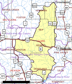
The Fivemile and Wedges Creeks Watershed is located in Clark County and is approximately 143 square miles in size. There are 244 miles of streams and rivers, 266 acres of lakes, and 10,418 acres of wetlands. The watershed is dominated by forest (65%), agriculture (12%), and wetlands (11%) and is ranked low for nonpoint source issues affecting streams and groundwater in the watershed.
Date 1999
Population, Land Use
The land use pattern in this watershed has not changed dramatically from pre-settlement times. Much of this watershed is owned by Clark County, consequently several streams are not affected by agricultural practices. However silvicultural practices within the county forest may cause damage to streams if best management practices are not implemented. Wisconsin DNR produced a field manual to address silvicultural impacts to water quality (WDNR, 1995). This manual should be used as a guideline to determine acceptable forestry practices adjacent to waterbodies and wetlands.
Date 1999

Ecological Landscapes
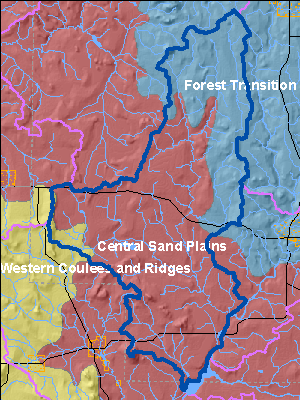
The Fivemile and Wedges Creeks Watershed is primarily located in the Central Sand Plains Ecological Landscape which is found in central Wisconsin, occurs on a flat, sandy lake plain, and supports agriculture, forestry, recreation, and wildlife management. The Ecological Landscape formed in and around what was once Glacial Lake Wisconsin, which contained glacial meltwater extending over 1.1 million acres at its highest stage. Soils are primarily sandy lake deposits, some with silt-loam loess caps. Sandstone buttes carved by rapid drainage of the glacial lake, or by wave action when they existed as islands in the lake, are distinctive features of this landscape.
The historic vegetation of the area included extensive wetlands of many types, including open bogs, shrub swamps, and sedge meadows. Prairies, oak forests, savannas and barrens also occurred in the Ecological Landscape. An area of more mesic forest with white pine and hemlock was found in the northwest portion, including a significant pinery in eastern Jackson County. Today, nearly half of the Ecological Landscape is nonforested, in agriculture and grassland. Most of the historic wetlands were drained early in the 1900s and are now used for vegetable cropping. The forested portion is mostly oak-dominated forest, followed by aspen and pines. A minor portion is maple-basswood forest and lowland hardwoods.
Date 2010
Wildlife and Habitat
Two aquatic dependent species of concern have been documented in this watershed. Management decisions should consider potential affects to these species. Other species may be present but not yet documented.
Date 1999
Watershed Recommendations
Date
Status
WDNR staff should continue to encourage communities to develop wellhead protection plans in the Watershed and the whole basin.
7/1/2010
Proposed
Mead Lake TMDL
Date
Status
TMDL Development for Mead Lake in Clark County, WI. Mead Lake is highly eutrophic and exhibits excessive concentrations of phosphorus and chlorophyll (a measure of algal densities) in its surface waters during the summer months (USACE 2005). Sediment and phosphorus enters the lake via the South Fork Eau Claire River, from nonpoint sources of pollution.
7/1/2007
In Progress
 Watershed History Note
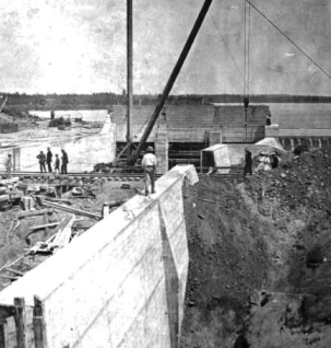
Hatfield, on the shores of Lake Arbutus, can be found at the southern boundary of the Fivemile and Wedges Creeks Watershed. Hatfield was founded by Norbert St. Germaine in 1836. The city was supported in the 19th century by the logging and lumber industry, as the Black River was a primary avenue for delivery of logs from central Wisconsin to the Mississippi valley. The Green Bay & Lake Pepin Railroad arrived in 1872. In 1907 a La Crosse Water Power Company dam was constructed just north of the Green Bay & Western tracks in Hatfield. This dam created what is known today as Lake Arbutus.
This fantastic picture captures both the dam construction and the west railroad bridge over the Black River with Lake Arbutus in the background.
Photo at right: Undated photo, from the collection of Bob Gile.
Date 2010