Details
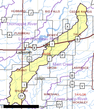
Deer Tail Creek is a low gradient, warm water drainage stream originating in
northeastern Rusk County and flowing southwesterly to its mouth on the Chippewa River near the Holcombe Flowage.
Its hydrology is flashy, with flow ranging from near zero to approximately two cubic feet per second. Near its headwaters this creek flows through forest and wetlands. but along its middle reaches pasture and agriculture dominate. More than 300 acres of wetlands border the stream.
One dam exists on Deer Tail Creek north of Glen Flora. This five foot head dam impounds 71-acre McGee Lake, the only lake in the watershed. Deer Tail Creek flows past two villages, Tony and Glen Flora, and receives treated wastewater at both sites.
Date 1996

Ecological Landscapes
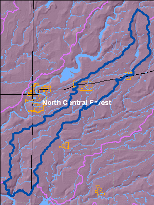
The North Central Forest Ecological Landscape occupies much of the northern third of Wisconsin. Its landforms are characterized by end and ground moraines with some pitted outwash and bedrock controlled areas. Kettle depressions and steep ridges are found in the northern portion. Two prominent areas in this Ecological Landscape are the Penokee-Gogebic Iron Range in the north extending into Michigan, and Timm's Hill, the highest point in Wisconsin (1,951 feet) in the south. Soils consist of sandy loam, sand, and silts. The vegetation is mainly forest, with many wetlands and some agriculture, though the growing season is not as favorable as it is in southern Wisconsin. Lake Superior greatly influences the northern portion of the Ecological Landscape especially during the winter season, producing greater snowfall than in most areas in Wisconsin.
The historic vegetation was primarily hemlock-hardwood forest dominated by hemlock, sugar maple, and yellow birch. There were some smaller areas of white and red pine forest scattered throughout the Ecological Landscape, and individual white pines trees were a component of the hemlock-hardwood forest. Harvesting hemlock to support the tanneries was common at the turn of the century, and the species soon became a minor component of forests due to over-harvesting and lack of regeneration. Currently, forests cover approximately 80% of this Ecological Landscape. The northern hardwood forest is dominant, made up of sugar maple, basswood, and red maple, and also including some scattered hemlock and white pine pockets within stands. The aspen-birch forest type group is also relatively abundant, followed by spruce-fir. A variety of wetland community types also are present, both forested and non-forested.
Date 2010
Fisheries
The creek supports a warm water sports fishery that includes northern pike, white suckers, minnows, and a variety of other warm water species, but the fishery is limited by low flows. Recreational use is very light.
Date 1996
Monitoring & ProjectsProjects including grants, restoration work and studies shown below have occurred in this watershed. Click the links below to read through the text. While these are not an exhaustive list of activities, they provide insight into the management activities happening in this watershed.
Watershed Recommendations
Date
Status
WT should conduct habitat evaluations to evaluate and document nonpoint source impacts on Deer Tail Creek.
1/1/2010
Proposed
Date
Status
Watershed Planning Project for FY09
1/1/2009
Proposed
Date
Status
WRM should conduct a water quality standards review on Deer Tail Creek.
1/1/2010
Proposed
Date
Status
WT should examine loadings of sediments and nutrients to Holcombe Flowage from Deer Tail Creek.
1/1/2010
Proposed